Did you know PC*MILER now offers street-level routing, mileage and mapping specific to the oil and gas industry? PC*MILER|Energy is a unique new solution that provides industry-critical routing and mileage data to make accurate planning and billing decisions when operating in the patch.
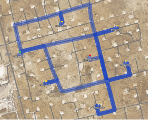
 Featuring the most comprehensive map* of oil and gas lease roads available in North America today, it includes both the public road network along with energy-specific access roads and infrastructure coverage in states and provinces where oil and gas wells are actively developed.
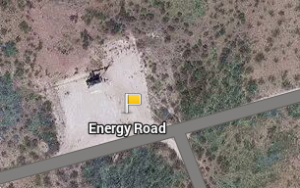
This integrated map data allows users to seamlessly plan a route, calculate mileage, and generate turn-by-turn directions from the public road network directly to locations in the patch. It also allows users to plot the lat/long of a well head and route directly to it, display a detailed satellite map view of the patch, and import custom locations of wells and facilities. Read more about PC*MILER|Energy
-----------------------------------------------------------------------------------------------
Want to view a live demo?
Register for our upcoming webinar for an in-depth overview and live demo of PC*MILER|Energy in action.
DATE: Thursday, November 20, 2014
TIME: 1:00 p.m EST
PRESENTED BY: Kara Jo O'Neil, Senior Product Manager, Enterprise Solutions
*Oil and gas field mapping powered by GEOTrac Systems Inc.


