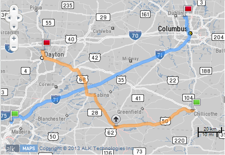
We’re very excited to announce the official release of our latest innovation, ALK Maps, a development tool used to create mapping and routing visualizations with our proven data sets and algorithms.
What is ALK Maps?
ALK Maps is a JavaScript API that developers can use to build their own mapping applications similar to Google Maps API or Bing Maps API. The key difference is, ALK Maps was designed specifically for the transportation and logistics industry, as it provides the industry standard truck-specific routing, mapping, geocoding and visualization found in our PC*MILER solutions. We are also planning to add international data coverage, similar to that used in our CoPilot Live Professional solutions which are currently available in over 50 countries worldwide.
We created ALK Maps in response to feedback from our commercial customers who were trying to use conventional mapping toolkits but found the routing capabilities lacking what they needed to calculate and display accurate commercial routes.
More importantly, what can you do with it?
ALK Maps enables you to overlay and visualize your own geographic data and combine it with the industry-standard commercial mapping and routing ALK has built over the last 30 years. Even though our desktop and mobile solutions are continuously being improved, many of our customers find value in integrating their own proprietary data and workflows with ALK's solutions.
Featuring an easy to learn JavaScript API, developers can begin a basic mapping web application in just a few lines of code. We've also included a number of examples and demos in our developer portal to help in getting started. In addition to routing, the ALK Maps API offers geocoding functionality to find addresses or translate latitude and longitude locations back into addresses. There are many functions to allow almost any kind of geographic data to be displayed over ALK Maps, enabling the creation of rich visualization applications. There are even weather and traffic overlays that can be included in the applications.
I have spent the past year creating ALK Maps with our Server and Web Applications Team and we couldn't be happier to present ALK Maps to all of you officially. Over the last few months a number of our customers have been beta testing the product and we're thrilled to hear they can't wait to get their hands on the finished product. Our work, of course, is never done and we are planning to continuously evolve and improve ALK Maps to ensure it is the best it can be.
To read more about the capabilities of ALK Maps or try it out yourself, visit www.alkmaps.com. Or feel free to post a comment or question here on the ALK blog!
Nick Springer
Director of Design and Web Applications

